


Ringkasan
An experiment exploring Google Earth satellite images through gesture. Doodle to begin.
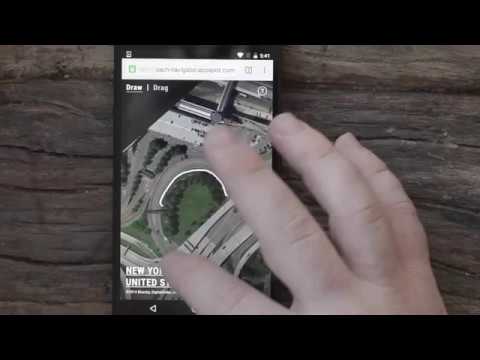
Satellite images provide a wealth of visual data from which we can visualize in interesting ways. Land Lines is an experiment that lets you explore Google Earth satellite imagery through gesture. “Draw” to find satellite images that match your every line; “Drag” to create an infinite line of connected rivers, highways and coastlines. Using a combination of machine learning, optimized algorithms, and graphics card power, the experiment is able to run efficiently on your phone’s web browser without a need for backend servers.
4,2 dari 510 rating
Detail
- Versi0.0.0.2
- Diupdate4 Januari 2017
- Ukuran39.24KiB
- BahasaEnglish
- Developer
- Non-pedagangDeveloper ini tidak mengidentifikasi diri sebagai pedagang. Bagi konsumen di Uni Eropa, perlu diperhatikan bahwa hak konsumen tidak berlaku untuk kontrak antara Anda dan developer ini.
Privasi

Kelola ekstensi dan pelajari cara penggunaannya di organisasi Anda
Developer belum memberikan informasi apa pun tentang pengumpulan atau penggunaan data Anda.